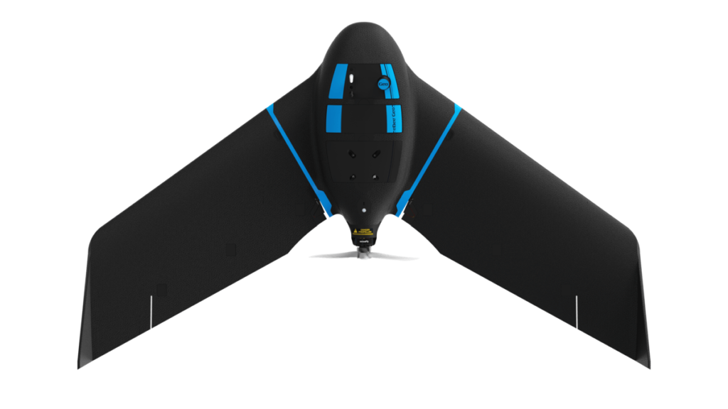
senseFly, the global leader in fixed-wing mapping drones, today announces the expansion of its flagship eBee X drone solution with the launch of eBee Geo. The eBee Geo represents the first extension into a new eBee X series of fixed-wing drones and is positioned as a cost-effective option for surveyors and GIS professionals who may be unfamiliar with fixed-wing drone mapping and data collection.
With a maximum 45-minute flight time, eBee Geo can achieve single-flight coverage of 160 ha at 122 m (395 A at 400 ft) – offering an ideal solution for smaller surveying firms and project-based drone service providers who are looking to upgrade their mapping capabilities while also meeting budget expectations. Operators across a range of verticals including construction, urban planning and land management can also benefit from the RGB imaging capabilities of the supplied senseFly S.O.D.A. camera fixed payload while achieving greater efficiency and absolute accuracy down to 2.5 cm thanks to the eBee Geo’s available Real-Time Kinematic (RTK) function.
The eBee Geo is designed from senseFly’s flagship eBee X fixed-wing drone, which revolutionized the unmanned aerial vehicle sector with its ease-of-use and multiple, state-of-the-art sensors designed to suit every mapping job, no matter how demanding. With a unique Endurance Extension option enabling a flight time of up to 90 minutes and single-flight coverage of up to 500 ha at 122m (1,236 A at 400 ft.), the eBee X is a premium solution that offers users the high-precision of on-demand RTK/PPK for achieving absolute accuracy of down to 1.5 cm (0.6 in) – without ground control points.
[perfectpullquote align=”full” bordertop=”false” cite=”” link=”” color=”#0000FF” class=”” size=””]“From listening extensively to our customers and understanding both their needs and pain points, we recognized a growing demand for a solution like the eBee X, but at a lower price point. The eBee Geo was designed with those needs in mind, offering better flight times, range and precision than quadcopters while also providing an accessible, yet professional, fixed-wing mapping solution.”[/perfectpullquote]
With eBee Geo, customers will also have access to senseFly’s untuitive eMotion flight planning software, technical support and resource offerings incluing its in-house team of experts, global distribution network and the newly launched senseFly Academy e-Learning Training Platform and Certified Operator Program.
senseFly eBee Geo is available in Canada exclusively from CartoCanada. Search the database here to find a distributor in the USA and remainder of the world.