
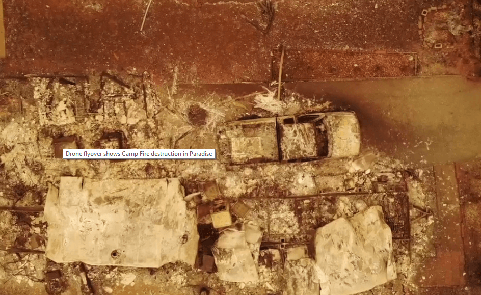
Under still-smoky skies, the drone video is a haunting journey through an apocalyptic landscape never seen before on this scale in California. Looking more like a movie set, the empty landscape is a grim reminder of how destructive these fires have been.
And now, emergency management officials are deploying teams of drone pilots around the town of Paradise to help remap the area from the sky. AFter thousands of acres of total destruction, crews need enhanced mapping tools to identify properties and even find their way around since all roadsigns and landmarks have been destroyed.
The 15 team drone deployment is believed to be the largest in California history. But they’re going to need a lot of time to collect images and process over 10,000 acres of terrain.
Rain is in the forecast for parts of California, which could help slow down it’s progress and allow responders to ‘catch up’ on it’s progress. But that weather change could also hamper the drone deployment as well as raise the risk of flash flooding.
Officials peg the death toll at 79, with hundreds still unaccounted for.
Please consider donating to the Red Cross, supporting the numerous evacuation centers they’ve opened to support the California residents who have fled the fires. You can make a donation at www.redcross.org, by calling 1-800-RED-CROSS. You can make an instant $10 donation by texting REDCROSS to 90999.